Sunday, January 31, 2010

Snow Map

The National Weather Service in Paducah, Kentucky has put together a map showing snow totals in their coverage area.


It is always interesting to see how these things pan out.

Here was our forecast from Thursday afternoon.


Overall, not too bad I think. There is no way I would have figured out that little tongue of heavier snow through southern Illinois. If you know anyone that could have, I'd like to shake their hand. haha

Saturday, January 30, 2010

8:15am Weather Update: Snow Totals

The band of snow that moved through overnight added a heft amount of snow to our overall storm total. I picked up 3.5" at my place in Cape Girardeau from 10pm Friday through 4am Saturday.

Here is a list of snowfall totals from StormTeam weather watchers, the NWS, Twitter, and Facebook.

Illinois:

  • Ava 9"
  • Harrisburg 8"
  • Vienna 7.7"
  • Eldorado 7"*
  • Jonesboro 6.5"
  • Cairo 5.5"
  • Cobden 5"*
  • Galatia 5"
  • West Frankfort 3.5"

Kentucky:

  • Paducah 4.7"

Missouri:

  • Mill Spring 9.5"
  • Bloomfield 9.5"
  • Ironton 9"
  • Greenville 8"*
  • Cape Girardeau 7.7"
  • 7 miles NW of Poplar Bluff 7.6"
  • Scott City 7.5"
  • Ellington 7"
  • Centerville 7"
  • Ellington 7"
  • Marble Hill 7"
  • Dexter 7"
  • Perryville 7"*
  • Farmington 7"
  • Bismark 6.5"
  • Fredericktown 6.5"
  • Portageville 6.5"
  • Jackson 6"*
  • Miner 6"
  • Potosi 4.4"
  • Old Appleton 4"*

Tennessee:

  • Paris 7.2"
  • Martin 7"

*Amounts submitted through Facebook and Twitter.

Friday, January 29, 2010

9:40pm Weather Update

Some pretty good snowfall totals coming in to the StormTeam Weather Center this evening. Here are a few of the totals. I will put a full write up on here the blog and on KFVS12.com sometime tomorrow.

Missouri:
  • Doniphan 7"
  • Poplar Bluff 5.8"
  • Ellsinore 5.5"
  • Malden 5.5"
  • Marble Hill 5.5"
  • Fisk 5.5"
  • Sikeston 5.5"
  • East Prairie 5"
  • Wappapello 5"
  • Van Buren 4.5"
  • Cape Girardeau 4.2"
  • Fredericktown 4"
  • Jackson 4"
  • Greenville 4"
  • East Prairie 4"
  • Benton 3"
  • Perryville 2"
Kentucky:
  • Fulton 4.5"
  • Benton 4"
  • Fairdealing 4"
  • Murray 2.5"
Illinois:
  • Anna 3.5"
  • Mounds 3"
  • Gallatia 1.2"
  • Marion 1.0"
Tennessee:
  • Martin 5"
  • Lake County 5"

It appears that we are going to have a lull in the snow for a little while. The lull is currently over south-central Missouri and over towards Poplar Bluff, Missouri. Just because the snow stops for a while tonight doesn't mean we are done with the snow. The upper-level portion of this storm still has to move through. I think snow will be possible in the area until mid-Saturday morning.

I've been working since 5:30 this morning. Needless to say, I am tired. I'm off to bed as I will be back up at 3:15am to go back in to work. I'm filling in for Laura Wibbenmeyer on The Weekend Breakfast Show.

7:30pm Weather Update

Weather update from the KFVS parking lot in Cape Girardeau, Missouri. I apologize for the upside down video. I was shooting with my iPhone and didn't realize it would make it upside down. (Just stand on your head. haha)

5:30pm Weather Update From Scott City

Reporting Not-So Live

I'm hanging out in Scott City, Missouri this evening. I'll be doing live reports on Heartland News at 5 and 6. Actually, I just finished the 5pm live shot.

Here is a video clip I shot with my iPhone when we first got here.


Sorry for the lack of updates today. We have been busy at the station. I had a post typed up ready to go around 2pm, but something happened with the blog host and I lost the post.

We're Dry

Everyone continues to ask this morning, "Hey, where's the snow?!?" Remember, we expect this event to last through Saturday morning. Also, we expect the heaviest snow to come in later today when there is better upper-level support.

One thing that is a little concerning to me is the dry air in place across southeast Missouri, southern Illinois, and western Kentucky. Dew points at 7am CT range from 9 in Farmington, Missouri to 12 in Poplar Bluff, Missouri. A northeasterly wind continues to draw in the dry air to the area. That dry air is helping to soak up the snow that is a few thousand feet up.

Take a look at this radar image I grabbed this morning. This is a 3D slice of the radar data. The bottom of the image is the ground. Each white line represents 10,000 feet.


You can see how some of the moisture is stuck up in the air several thousand feet. That is why the radar continues to show snow but when you go outside there isn't anything falling. As the snow falls, it is getting soaked up.

Once we get the air saturated a bit more, the snow should start to reach the ground.

Thursday, January 28, 2010

9:15pm Weather Update

Reports of freezing rain and sleet are starting to come in from northeast Arkansas. I have also gotten a report of sleet in Kennett, Missouri.

The forecast appears to be on-track. I just got word that one of the hyper-local forecast models is putting out around 6.3" of snow for Cape Girardeau, Missouri. Before you ask, this is the only point data is available to me with this specific model.

The Hydrometeorological Prediction Center just put out their latest winter weather forecast.

In the upper left panel is the probability forecast of at least 4" of snow. In the upper right panel is the probability forecast of at least 8" or greater snow. In the bottom left panel is the probability forecast of at least 12" or greater snow. In the bottom right panel is the probability forecast for at least 0.25" ice accumulation.

It appears that the forecasters at HPC are thinking along the same lines with me. That always makes me feel better when I go out on a limb with a big snow forecast.

Give us an Eye

Do you have a webcam that is pointed out your window or giving you a view of the outside? If it is online, KFVS would like to be able to use it. We might use the image online or on-air during Winter Storm 2010.

If you do have a cam as stated above, leave a comment with the details of its location online (along with the location -city, state-). If you don't want to leave the information on my blog, feel free to email me the information at jdissauer@kfvs12.com or send me a DM on twitter @johndissauer.

Looking at the Forecast

Snow Forecast Finished

Just got finished putting the final touches on the snow forecast. Bob Reeves will be showing it tonight on Heartland News at 5, 6, and 10 but of course you get the sneak peek here on "New at Dis Hour".


The above snowfall amounts are for the entire storm. The snow will most likely not finish until Saturday morning and possibly as late as late morning.

How much do you think we will see?

Models Shaking Hands

I'm still going over the data with my own methods for forecast snowfall amounts. Here is what the two computer models (GFS & NAM) are showing from this morning's runs.

GFS:


NAM:


They are starting to come in line with each other.

Snowfall amounts will be heaviest over the southern third of the KFVS viewing area. I don't think it is out of the question that we could see a 13" snowfall report before this storm is over. Stay tuned...

Feeling a Bit More Comfortable

I'm feeling a bit more comfortable with the precipitation numbers coming in from the morning data. I'm currently working on a forecast right now. It takes a little time as I have to extrapolate the data by hand. I hope to have the forecast finished in a little bit.


Thursday Morning Data Update

Up and going this morning. Well, I am up not so much going. I think I am stuck in first gear and need to grind in to third or fourth gear.

Winter Storm Watches have been replaced by Winter Storm WARNINGS and Advisories for parts of southeast Missouri, southern Illinois, western Kentucky, northwest Tennessee, and northeast Arkansas. The warnings and advisories generally go in to effect Thursday night and continue through Friday night.


I have been having a hard time getting in phase or in sync with this storm. Usually I don't have a problem getting in phase with winter storms because I am able to dive in to all of the data run to run, but having been out of town on a business trip has made it a little more tricky.

All along I have been thinking that the heaviest band of snow could setup along a line from roughly Poplar Bluff, Missouri to Paducah. I am thinking the heavy snow band will develop slightly south of that line. As is usually the case, everything depends on the track of the storm.

How much snow we get will also be highly dependent on the amount of moisture. There is still not a lot of agreement between the models as to how much moisture there will be. The other thing to watch will be storm development south along the gulf coast. In the past I have seen storms develop along the gulf coast and rob the moisture. That doesn't appear to be the case this time, but it is something to watch.

At this point, I do not feel comfortable giving a snow forecast yet and to be honest I don't know if I will be able to give one of my "John Dissauer snowfall forecasts" like I have done in the past. I usually only give those when I feel very comfortable and feel like I have a good grasp of this storm. That being said, I will still be giving out information and guesstimates.

As I am still formulating what I will be going with, here is a couple of different looks for data across the area. Before everyone starts to ask "What about Illinois? What about the bootheel?", I don't make the following graphics myself. The graphics are generated from data points provided by NOAA and they set the data points. There aren't any data points for the data that generates these graphics in southern Illinois and the Missouri bootheel. And the following is NOT the forecast. The data is simply that. Just data output from the computer models.

Each line represents a different model run. There are two different models represented, the GFS and the NAM. The fifth line is the forecast from the National Weather Service.

Cape Girardeau, Missouri:


Farmington, Missouri:


Paducah, Kentucky:


Jonesboro, Arkansas:


For locations not shown above, you can extrapolate the amounts from above and get an estimate of where you could fall.

As you can see from the data, each model seems to be very consistent with itself, but the models aren't consistent with each other. That is what makes this forecast difficult.

How much snow do you think we will get?

This is just talking about snow. There will be some significant icing south of the Missouri bootheel. In fact, I have this weird suspicion that the freezing rain could drift a little further north. That being said, we are still NOT looking at an ice storm like last year.

Here is a "human reviewed" look from the HPC. This graphic shows you probabilities of different types of winter weather for Friday. Remember, this is showing probabilities not whether or not you are getting snow, ice, etc.


Wednesday, January 27, 2010

Evening TV Forecast

Here is the TV forecast from Heartland News at 6pm CT.

Winter Storm Watch

Winter Storm Watches will be in effect Thursday evening through Friday afternoon for most of southeast Missouri, southern Illinois, western Kentucky, northwest Tennessee, and northeast Arkansas.


I had a question on one of my previous posts as to why some counties aren't included in the watch. Just because a specific county isn't included in the watch doesn't mean you will not get any snow. Each National Weather Service office has their own criteria for a Winter Storm Watch. Below is a listing of all the criteria for a Winter Storm Watch for the surrounding NWS offices.

Memphis, TN: Issued if there is a threat of heavy snow or sleet, significant accumulations of
freezing rain or freezing drizzle, or any combination thereof. Usually issued for the
second and third periods of a forecast (i.e., 12 to 36 hours in advance of the event).
The definition of heavy snow, sleet, ice or any combination of the above in the Memphis forecast area is an average of at least 4 inches or more in 12 hours, or 6 inches or more in 24 hours.

Paducah, KY: Issued if there is a threat of heavy snow or sleet, significant accumulations of
freezing rain or freezing drizzle, or any combination thereof. Usually issued for the
second and third periods of a forecast (i.e., 12 to 36 hours in advance of the event).
The definition of heavy snow in the Paducah forecast area is an average of at least 4
inches or more in 12 hours, or 6 inches or more in 24 hours.

St. Louis, MO: A watch is used when the risk of hazardous winter weather has increased significantly, there is a strong possibility it will reach warning criteria, and falls in the 12 to 48 hour portion of the forecast.

Winter Storm Update: Wednesday Data Update

I apologize for the lack of posts yesterday. I am still enroute back home after spending a couple of days in Biloxi, Mississippi at a Digital Media Conference with KFVS' parent company, Raycom Media.

I am going over some information from last night's 0z run (6pm CT) and the 6z (12am) run of the models. Snowfall amounts still look impressive for parts of southeast Missouri, southern Illinois, and western Kentucky.

First of all, for most of the area we are talking about ALL snow. Here is the 0z GFS run for Cape Girardeau. It is showing the atmosphere being supportive of all snow starting around 7pm CT Thursday. That being said, there could be a little sleet at the onset.


The above image is using a program called BUFKIT. BUFKIT is great because it allows for a visualization of the atmosphere. Unfortunately, there are only specific data points available for the BUFKIT in the KFVS viewing area (Cape Girardeau, Farmington, and Paducah). This is the reason why I haven't been giving any data for southern Illinois. There isn't data available. Don't blame me. Blame NOAA. :)

Some of the snowfall totals from the GFS through BUFKIT:
  • Cape Girardeau, Missouri: 10.4"
  • Evansville, Indiana: 4.8"
  • Farmington, Missouri: 11"
  • Jonesboro, Arkansas: 9"
  • Paducah, Kentucky: 9.2"
  • St. Louis, Missouri: 5.6"

Here is a different look at the 6z run of the GFS. The map is displaying snowfall totals through 6am CT Saturday.


Finally, the NAM forecast model is starting to come in line with the snow, albeit not as agressive as the GFS. Here is the 6z run of the NAM's depiction of snowfall amounts.


Finally, here is another map I have just come across. This is displaying the 0z run of the GFS for the KFVS viewing area.

As you can see, the models are suggesting amounts anywhere from 2" to up to 12" of snow across the region. Notice there is a little variance from the 6z run of the same model as the 6z run (US map earlier in post) has the heavy 10"-12" band of snow a little further east.

PLEASE keep in mind the above numbers are straight from the model. These numbers are NOT the forecast amounts. As soon as my snow forecast is finished, I'll be sure to have it on Heartland News on KFVS and here on the blog. I will be back at work this afternoon and I am filling in for Bob Reeves tonight on Heartland News.

Special thanks to Bob Evans for the use of their free wifi. I've been sitting here typing up the blog while eating breakfast before finally getting home.

Tuesday, January 26, 2010

Winter Storm Update: Tuesday Morning Data

The new Tuesday morning run of the GFS is in. I'm quickly digesting some of the data for the southeast Missouri, southern Illinois, western Kentucky, northwest Tennessee, and northeast Arkansas area.

It still looks like it is going to be a primarily ALL SNOW event for the area. There are a few exceptions to that in northeast Arkansas and western Tennessee.

Here is a view at the data for Cape Girardeau, Missouri:


Other points of snowfall amounts:

  • Cape Girardeau, Missouri: 8.8"
  • Farmington, Missouri: 7.3"
  • Jonesboro, Arkansas: 8.9"
  • Paducah, Kentucky: 9.4"
  • St. Louis, Missouri: 0.4"

I have had several people asking about other points in the Missouri bootheel and southern Illinois. Unfortunately, NOAA only provides data points for this type of data for specific locations in the area. There aren't any locations in either the bootheel or in southern Illinois. Of course on air we will be giving forecasts for the entire area.

With this storm the track means everything. There will be a very sharp cut-off of snow on the north side of the storm. A deviation of the storm track of 25-30 miles could mean the difference in getting 0" instead of 6" of snow.

The above numbers are not our forecast. These are just numbers from a computer model.

Winter Storm Looking Likely

Just as the title of this post says, a major winter storm is looking more likely Thursday and Friday for parts of Missouri, Illinois, Kentucky, Tennessee, and Arkansas.

I am looking over new data just in from the night runs of NOAA's global forecast model (GFS). If I were to have to make a snow forecast with the data in hand right now, I would have to say that the heaviest band of snow could be setting up along a line from Poplar Bluff, Missouri and Paducah, Kentucky. Snow will also be north and south of that line. Snow could even be falling from eastern Arkansas in to western Tennessee.

For Cape Girardeau, the precipitation type looks to be all snow. The amount of precipitation is pretty impressive. The GFS pumps out 0.82" of liquid. Even on a 10:1 ratio would bring the snowfall amount to 8.2" of snow. Using a couple of different methods shows that the snow ratio could be between 10:1 to 17:1. The ratio could be going up through the event as the cold air moves in. Overall, tonight's GFS run puts down 11.4" of snow. That's a decent amount. ;)

As I mentioned, it looks like it will be snow south of the area as well. In Jonesboro, Arkansas it looks like it will start out as rain. Then mixing with perhaps an hour or two of freezing rain (1/4"?). Then it changes over to all snow. Quite a bit of snow in Jonesboro too. Perhaps around 8.7".

Here are some of the other model's snowfall amounts.

  • Evansville, Indiana: 7.8"
  • Farmington, Missouri: 11.1"
  • Louisville, Kentucky: 7.9"
  • Paducah, Kentucky: 13.5"
  • St. Louis, Missouri: 0"

It appears that there will be a pretty sharp cut-off of the snow on the northern edge of the band.

Keep in mind the amounts mentioned above are not forecast amounts. These are numbers coming straight from the computer model. We will continue to be going over the weather data over the next 60-72 hours.

Bottom line... How much snow is still in question. As of right now, it appears that the biggest threat for southeast Missouri, southern Illinois, and western Kentucky will be snow.

Monday, January 25, 2010

Winter Storm Update

I am currently in Biloxi, Mississippi at a Raycom Media Digital Media Conference, but I wanted to update you on the possible winter storm moving towards southeast Missouri, southern Illinois, western Kentucky, northwest Tennessee, and northeast Arkansas.

To be honest, models are all over the place with this storm. There isn't much run to run consistency between the longer run models (NOAA's global forecast model, GFS, and the European meteorology agency's ECMWF). Because of the inconsistent runs precipitation types and amounts vary greatly.

I just took a look at this morning's GFS run. Snow lovers you will like this. Here is a look at the data for Cape Girardeau, Missouri.


From 6pm CT Thursday to 3pm CT Friday, this model is putting down 0.85" of liquid precipitation. Surface temperatures during this time period (red line) would be below freezing so everything would fall as snow. After all of the calculations the GFS is suggesting 12" of snow. That is a lot of snow! Conversely, last night's run of the model kept the precipitation in Cape Girardeau as all rain.

Here are a few other amounts of snow suggested by the GFS for Thursday-Friday.
  • Farmington, Missouri: 7.5"
  • Paducah, Kentucky: 10.9"
  • St. Louis, Missouri: 0"
Note about the winter storm... If this does happen Thursday/Friday, it would happen exactly one year after the 2009 ice storm that crippled the area.

Something else to notice, look at the temperatures following the snow. Temperatures plunge to below zero. It is a little hard to tell how cold we will drop just yet, but if there is a substantial snow pack on the ground, it is likely we would drop below zero.

Stay tuned...

Saturday, January 23, 2010

Winter Storm Chatter

There have been a lot of people asking me about a winter storm or an ice storm coming so I thought I should address it.

Yes, there is potential for a winter storm moving through southeast Missouri, southern Illinois, western Kentucky, northwest Tennessee, and northeast Arkansas later this week. Models seem to be pointing at Thursday/Friday.

At this point it is purely "potential". I haven't seen enough indicators or consistency in the computer models to get me excited about it just yet.

There are a lot of questions regarding this storm.
  1. What is the track?
  2. How warm will it be ahead of the storm?
  3. What kind of cold air do we have to work with?
  4. Will there be a shallow layer of cold air at the surface and warm air above?
All of these questions need to be answered before we can determine if this will bring rain, thunderstorms, snow, sleet, or ice.

I can show you what this morning's run of NOAA's global forecast model is showing. Here is the data for Cape Girardeau, Missouri.

You can see how the model brings in snow by Thursday morning. The moisture amounts aren't that impressive. When it changes over to all snow, there is 0.275" of liquid to work with which would come out to around 3.3" of snow. Conversely, last night's run of the same model was indicating a little over 14" of snow for Cape Girardeau. This morning's run also puts down 9" of snow for Paducah, Kentucky. As you can see, there are huge swings in the models from run to run. I would like to see them settle down a little bit before I start to get excited.
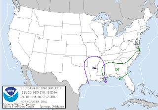
Does this storm bear watching? Absolutely, but I wouldn't go out and make a run on the grocery stores just yet.

Risk of Storms Tonight

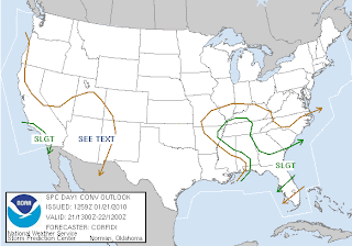
The Storm Prediction Center includes parts of southeast Missouri, western Kentucky, northwest Tennessee, and northeast Arkansas in a "Slight Risk" of seeing severe weather in their 10:30am CT severe weather outlook.

In their discussion, SPC points at damaging wind being the main threat from any storms that develop later this evening in southeast Missouri, western Kentucky, northwest Tennessee.

Here is a look at this morning 6am CT run of the NAM computer forecast model for Paducah, Kentucky.

A couple of things to note.
  1. Look at the temperature. If the NAM is correct, temperatures will run in the upper 50's this afternoon.
  2. Look at the dew point. Dew points are forecast to be up to around 50° this afternoon. Remember, the dew point is basically the measure of the moisture in the atmosphere.
  3. Look at the wind. These are indicated by the multi-colored lines covering the screen. Each line indicates a specific wind speed (in knots) at a specific height. Use the legend in white text on the right of the screen to see the altitude in 1,000's of feet. Winds will be strong and gusty this afternoon. The model indicates sustained winds of 25 knots (approximate 29 mph) by afternoon. Go up a few thousand feet later this evening and you will see the winds increase to 60-70 knots (69-80 mph).
  4. Look at the precipitation. By the NAM's indications, rain will begin to fall around 9pm-10pm CT and will last until early Sunday morning.
For cool-season severe weather in this area numbers 1, 2, and 3 from above are important. Often times, numbers 2 and 3 are most important. As I mentioned earlier, a local NWS study showed that the risk of severe weather greatly increases around this region when dew points climb above 48°. When you combine that with strong winds a few thousand feet above the surface, it wouldn't take much for a thunderstorm to force some of that wind down to the ground.

I agree with the Storm Prediction Center's assessment that the main threat from storms tonight will be damaging wind.

All of this being said, the instability isn't horribly impressive. Typically, we don't need a lot of instability for cool-season thunderstorms to become severe, but you do need some instability to get the thunderstorms started. This becomes one of the big questions, "Can we get thunderstorms to initialize?"

Right now it appears that the best chance for strong to severe thunderstorms will be later this evening. Perhaps as early as 9pm CT (Saturday) through 2am CT (Sunday).

As far as rainfall amounts, the NAM is putting down 1.9" of rain for Paducah, 1.75" for Cape Girardeau, Missouri, and 0.82" for Farmington, Missouri. I don't think we'll see any flash flooding, but look at the 3-hour Flash Flood Guidance put out by the National Weather Service.

We could be up on the edge of the amounts shown in the map so we'll have to keep a close eye on it.

Stay tuned...

Thursday, January 21, 2010

Tornado Watch #6

The Storm Prediction Center has issued Tornado Watch #6 for parts of southeast Missouri, western Kentucky, northwest Tennessee, and northeast Arkansas. The watch is in effect until 5:00pm CT Thursday.

A tornado watch means that conditions are favorable for the development of thunderstorms capable of producing large hail, damaging wind, and tornadoes.

Storms are expected to move to the northeast at around 40mph.

10:15am Weather Update

The Storm Prediction Center is monitoring the Missouri bootheel, eastern Arkansas and western Tennessee for storm development. They recently put out a Mesoscale Discussion for the region.


In the discussion they mentioned that storms should begin to redevelop in this region. They also said that they expect to be issuing a Tornado Watch by noon CT. Stay tuned...

Storms Again Today

Thunderstorms have been rumbling through the Missouri bootheel this morning. Some of the storms have produced small hail.

Here is the a radar image from :


The Storm Prediction Center is indicating a chance of severe storms through 6am CT Friday for parts of western Kentucky and northwest Tennessee.

The main threat will be hail.

Wednesday, January 20, 2010

11:10pm Radar Update

Here is the latest radar image from the Paducah, Kentucky NWS site. The image is from 11:10pm CT.

Tuesday, January 19, 2010

Overnight Hail?

The Storm Prediction Center has put out one of their "Mesoscale Discussions" for parts of southern Missouri, western Arkansas, and eastern Oklahoma. SPC forecasters put out a Mesoscale Discussion when there are specific areas they are watching for the possibility for severe weather development and winter weather development. Tonight's MD is out for the potential for hail.


Many times meteorologists can get an good indication if SPC will issue a watch for a particular area.

At this time it doesn't appear that SPC will be issuing a Severe Thunderstorm Watch. The limiting factor is storm development should be too sporadic.

Bottom line... If you are in southeast Missouri, especially towards the Ozarks, don't be surprised to hear some rumbles of thunder overnight.

Threat Still There

Looking over this morning's runs of the computer models keeps me intrigued about this weekends chance of thunderstorms.

Lets take a look at a few of the parameters we need for storm development.

300mb (Jet stream) Winds:

The nose of the jet streak is rounding the trough and is shooting right in to southern Missouri. The above image depicts .

Surface Moisture (Dew Points):

Dew points are often times a huge player in cool-season severe storms. A recent NWS study from the Paducah, Kentucky office has shown that the possibility of cool-season severe storms substantially increases when dew points rise above 48°. This model is indicating dew points over 50° Saturday night.

Instability:

When looking at the instability it doesn't look that impressive. You can see a bulls eye of heightened CAPE over the region at 6am CT with values around 500 j/kg. Normally that wouldn't be too impressive. However, will cool-season storms, it has been found that instability isn't a huge player for severe storms to develop. To give some perspective, CAPEs will often times be over 3,000 - 4,000 j/kg (if not higher) in the summer.

The Storm Prediction Center continues to indicate the best risk of severe weather is south of the area. I wouldn't be surprised if this area starts to slide further north over the next couple of days.


With a strong jet stream over the top of the region helping draw up moisture, it appears we could have some pretty hefty rainfall totals too. Here is the GFS' depiction of 24 hour rainfall totals ending 6am CT Sunday.


The GFS is indicating over 1.5" of rain Saturday evening through Sunday morning.

At this point, it appears the best time for severe weather, if we see any, would be late Saturday night/early Sunday morning. That being said, we are still 110-120 hours away from this possibly happening. Lots of things could change between now and then. In fact, the storm hasn't even made its way onshore. As we have seen before, the models can and usually do change things up a little once they get better samples of data when the storm moves over land.

Bottom line. Stay tuned...

By the way, I am hoping that if we do see severe storms Saturday night they don't last too late. I've got to be up EARLY Sunday to catch a plane to a Digital Media conference so I don't need to have an all nighter. Mother Nature, if you are listening, please take that in to consideration. haha

Monday, January 18, 2010

Thunder Still Possible

Thunderstorms are still possible for the weekend.

Forecast models have been advertising warmer air moving up the Mississippi River Valley later this week ahead of an area of low pressure moving across the country. As previously mentioned, with the warm, moist air in place interacting with a cold front passing through early Sunday morning there will be a chance of thunderstorms.

Looking at the jet stream in the atmosphere (30,000'-35,000') shows energy coming out of the south-central United States.

Here is a look at the GFS model's depiction of the 300mb level at 6pm CT Saturday.


The nose of the jet streak comes around the upper-level low across the central Plains. The nose of the jet streak is shown moving up in to southern Missouri. If this holds true, strong thunderstorms (perhaps severe) will develop across eastern Arkansas, northern Mississippi, and extreme western Tennessee.

The Storm Prediction Center has taken notice of the possibility of severe weather. They have highlighted areas of Arkansas (and south) for the potential for strong storms.


The question would be how far north could the strong storms develop?

A local study by the National Weather Service shows that "cool season" severe thunderstorms do not need a lot of instability to thrive. They just need marginal moisture amounts (dew points), a decent cold front, and wind aloft.

Stay tuned...

Friday, January 15, 2010

The Week at a Glance

I was just looking at some data for the next week. It looks as though temperatures will go back towards normal if not slightly above normal.

Here is the 12z GFS model's depiction for Cape Girardeau, Missouri.

Reminder: Time reads from right to left. Red line is air temperature at surface. Green bars indicate rain. Grey blocks indicate clouds.

All of the models are bringing rain in to southeast Missouri, southern Illinois, and western Kentucky for the weekend. This run of the GFS is putting down around 0.2" of rain. As you can see, it brings the rain in Saturday evening and moves it our early Sunday.

I want you to look towards the end of the time line (left side). Notice the temperatures? It is showing a high temperature in the middle 50's. Not indicated on the above graphic is what could be coming for the following couple of days. One of the models is hinting at a decent storm moving through the central United States. Not so much of a snow or ice storm, but perhaps thunderstorms.

Here is a look at the 300mb chart. This shows where the jet stream is located.

The model is hinting at a nice jet streak shooting up through Arkansas and Missouri. To the southeast of the jet streak, temperatures would most likely warm in to the 50's (and 60's south). Moisture from the Gulf of Mexico would be streamed up ahead of the storm. Put all of those ingredients together and we could be talking about a severe weather outbreak for someone from the middle Mississippi River Valley to the Gulf Coast.

This is still 240 hours away so a lot will likely change between now and then. In fact, I wouldn't be surprised if this storm doesn't develop. However, it is something to keep an eye on as it isn't unusual for us to see thunderstorms in January or February.

Tuesday, January 12, 2010

Invest in Long Underwear

It has already been well established that 2010 has started off on a cold note. The question is, "How cold has it been?"

Cape Girardeau, Missouri:
As of January 11, Cape Girardeau is 14.7° below average per day for the month of January. That equates to a temperature deficit of almost 162°.

For the first eleven days of the year, the average high temperature has been 25.9° and the average low temperature has been 9.1°. The extremes during that time period have been 38° on January 11 and -2° on January 10. Ten days of the month (91%) have had a high temperature of 32° or below.


Carbondale, Illinois:
As of January 11, Carbondale is 13° below average per day for the month of January. That equates to a temperature deficit of 143°.

For the first eleven days of the year the average high temperature has been 25° and the average low temperature has been 9.3°. The extremes during that time period have been 35° on January 11 and -5° on January 10. Ten days of the month (91%) have had a high temperature 32° or below.


Paducah, Kentucky:
As of January 11, Paducah is 14.7° below average per day for the month of January. That equates to a temperature deficit of almost 162°.

For the first eleven days of the year, the average high temperature has been 25.7° and the average low temperature has been 10.5°. The extremes during that period have been 36° on January 11 and 1° on January 10. Ten days of the month (91%) have had a high temperature of 32° or below.


Poplar Bluff, Missouri:
As of January 11, Poplar Bluff is 11.6° below average per day for the month of January. That equates to a temperature deficit of almost 128°.

For the first eleven days of the year, the average high temperature has been 29.1° and the average low temperature has been 12.6°. The extremes during that period have been 44° on January 11 and 5° on January 10. Nine days of the month (82%) have had a high temperature of 32° or below.

Monday, January 11, 2010

The Streak Is Over

It is time to pop the cork on the champagne bottles. The streak is over. We've gone above freezing!

I just checked out at the Cape Girardeau Regional Airport and the temperature at 11:45am CT is 1°C or 33°F.

The streak at or below freezing ends at 260 hours.

Sunday, January 10, 2010

Coldest Morning of the Year

It is cold outside! This morning was the coldest morning of the year.

Take a look at low temperatures this morning.


We start to slowly warm-up today. High temperatures will be in the 20's across southeast Missouri, southern Illinois, western Kentucky, and northwest Tennessee. It looks as though we will finally get up about freezing (32°F) Wednesday.

Cold streak update: As of 6:00am CT the streak continues at 231 consecutive hours at or below 32°F.

Saturday, January 9, 2010

Look At January Temps

Here is a look at high temperatures at the Cape Girardeau Regional Airport during our cold stretch. The graphic goes back to December 31.


By the way, the high temperature for today was 19°.

As of 10pm CT tonight, we are now at 223 consecutive hours of 32° or colder.

Not So Fast

New data in this morning is indicating that we could be adding on to the "at or below freezing temperature" streak for a while longer.

Forecast models are hinting at a temperature inversion setting up over the area. This happens quite often around here in the winter. Normally, temperature decreases with altitude. Hence, it is colder on the top of a mountain than at its base. A temperature inversion is an increase in temperature with altitude.

The inversion acts as a block to trap the cold air at the surface. It doesn't allow it to mix and can often times help in the creation of a low deck of clouds or fog.

Here is the 12z run of the NAM model. Notice all of the low clouds it keeps over the top of the area?


I have several weather parameters displaying on the image. First, surface air temperature is the red line. Blue vertical bars indicate snow. Orange vertical bars indicate sleet. Yellow lines indicate air temperature at different elevations. The first vertical set of numbers on the right side of the screen indicates the elevation in 1,000's of feet. For example 4k=4,000'.

As long as the inversion is set up, we might have a hard time of getting enough sunshine to warm us above 32°F. Notice the high temperature on Monday is around 30° and in the upper 20°'s on Tuesday.

I find temperatures difficult to forecast when we have inversions setup. Mainly because we don't always get the cloud formation. Sometimes the models will indicate sunny skies, because they have a hard time resolving what is going on in the lower couple hundred feet of the atmosphere, and it will end up being cloudy.

Friday, January 8, 2010

We've Been Cold For How Long?!?

2010 has really started off on a cold note and it looks as though we are going to remain cold for the next several days.

The high temperature at the Cape Girardeau airport has been below freezing (32°F/0°C) every hour of the new year. We can even go back a couple of hours in 2009 to start our cold streak. The last time we were above freezing was at approximately 2:45pm CT December 31, 2009.

As of 3:00pm CT today, the temperature at the Cape Girardeau airport was 16°. That means the streak continues at 192 hours at or below freezing.


To give some perspective as to how cold we have been this month we are 13.5° below average per day (through January 7). That equates to a temperature deficit of 94.5°.

Now the question everyone wants to know... When will it start to warm back up? To answer that, lets take a look at temperatures from one of the computer models.


I have drawn in the 32° line (approximately) on the image above. Follow the red line from right to left and see when it touches or goes above the line.

It looks as though we might get near 32° by Monday afternoon. If not Monday, it appears that Tuesday would be a best shot. If this is the case, we will add anywhere from an additional 72 hours (Monday afternoon) or 96 hours (Tuesday afternoon) to our temperature streak. That would take our consecutive at or below freezing streak to 264 hours or 288 hours.

Thursday, January 7, 2010

Forecast Verification; How'd We Do?

Now that the flakes have settled, figuratively speaking as it will be windy for several hours, it is time to take a look back on the forecast and see how we did.

Here is our forecast from Tuesday afternoon. At the bottom of the image is our forecast. Overlayed in the smaller yellow text is reports of snow from co-op oberservers, the National Weather Service, and the public. (click the image to see a larger version)

Yes, we were a little "heavy" for our southern counties. Wednesday night I thought that might happen as the last run of data came in before the snow really hit. I got a little bit by the higher elevation of the Missouri Ozarks. That location is always a tricky place to forecast. Often times they will get higher amounts than what the models advertise. At least I got the timing about right as to when the snow would start falling.

Overall, I think we did a pretty good job. What do you think?

Round 1 Over; Round 2 Knocking

The snow is coming to an end across the area. There is one final band that is dropping 1/4" to 1/2" of snow as it exits.

For the most part the forecast is working out pretty well. Snowfall amounts are ranging from 1/4" to 4.5" from southern Illinois, southeast Missouri, and western Kentucky. We'll be getting better numbers in as we go through the morning.

I have taken several snow readings overnight and this morning with my Snoopy ruler. (This is the same ruler I have been using for snow measurements for over 10 years.) At midnight I had 0.75". At 5am I had another 1.2". At 7am I had another 0.4". So my total is 2.3".


As we have been saying for several days, the snow is just the first part of this storm. The second round is starting to move in.
Northwesterly winds are beginning to pick-up behind a cold front that is pushing all of the snow out of the region. Those winds are ushering in colder air.
Take a look at 7:00am CT temperatures around the region.


Temperatures will most likely sit in the lower to middle teens througout the day as the cold air continues to move in. Winds will increase to 10-20 mph with higher gusts. That will create wind chills to near 0 degrees at times.

12:10am Weather Update

I got my trusty Snoopy ruler out of the desk and went outside to measure how much snow I've got at my place. As of midnight, 0.75" and it is still coming down.

This Snoopy ruler has been through several snow storms with me over the years. I've had it since elementary school. I have know idea how I have been able to keep a plastic ruler for so many years without breaking it.

Here is a shot of cars covered with snow tonight in Cape Girardeau, Missouri.

11:15pm Weather Update

Snow reports are slow to come in tonight. So far the heaviest amounts have been from Ste. Genevieve, Missouri - 2" and a couple of miles northwest of Farmington, Missouri - 1.5".

I am glancing over some of the new data coming in... Will be interested to see if the 0z NAM is on to something. It is trying to split some of the moisture north and south around parts of southeast Missouri, western Kentucky, northwest Tennessee, and northeast Arkansas. If this is to pan out, it might be a struggle to get up to 1" over the Missouri bootheel and southern sections of western Kentucky/northwest Tennessee.

Heaviest amounts still appear to be on track with the forecast.

Wednesday, January 6, 2010

Holly Brantley Reporting

My good friends Holly Brantley and photographer Rochelle Steffan shot a report for my blog tonight. Thanks girls!


First Snow Video

Thanks to Heartland News photographer Rochelle Steffan we have our first look at some snow video.


She shot this in Fruitland, Missouri. She is hanging out waiting for her live shot for Heartland News at 10pm.

First Picture

We have our first snow picture in to the StormTeam Weather Center. This comes from Amber Nelson in Park Hills, Missouri. Thanks Amber!


If you have pictures you would like to send in, send them to cNews.

So far I haven't gotten any snow depth reports from anyone. If you have them, send them to us via Twitter @kfvsweather and to me @johndissauer.